KFCA Community Maps:
King Farm Overall Community Map:
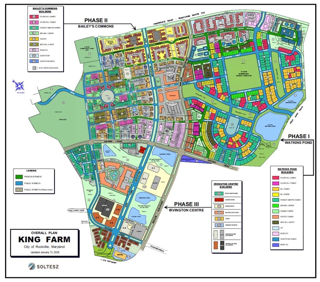
Please refer to the Legend(s) on the map below. GREEN Streets are Private (King Farm) streets, BLUE Streets are Public (City of Rockville) streets; GRAY Streets (Redland Blvd. and Gaither Rd.) are also Public City of Rockville streets. Public streets are maintained by the City. Frederick Road – MD Route 355 is the responsibility of the State of Maryland Transportation Department.
Please click here to view the full-sized copy of the map.
Shopping and Dining
Need to make reservations for dinner tonight? Need to ask one of the Village Center businesses a question? This link helps put you in touch with King Farm’s retail and restaurant establishments.
Housing Types Map
A map that shows the different types of homes in our community.
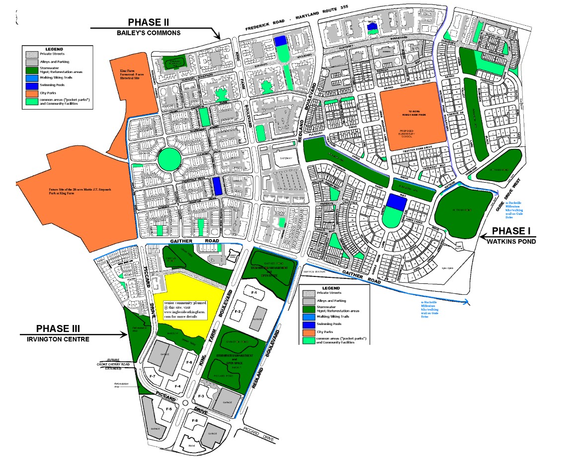
Recreation – Amenities Map
A detailed illustration of the different areas of King Farm dedicated to recreation and leisure activities. Everything from biking trails to playgrounds to sitting areas can be found on this map.